from streamlining maintenance tasks to fostering resident engagement.
MONGOVEN MAPPING & GIS SERVICES
The possibilities unlocked by GIS mapping are endless. From the manicured greens of a golf course to the bustling streets of a city, GIS brings data to life, empowering informed decisions and unlocking potential across diverse sectors.
The core competency of Mongoven Mapping & GIS Services is a combination of experience managing property assets, specifically landscaping, irrigation, lighting and drainage systems and the ability to use GIS Technology. Leveraging will reduce the labor needed for the task of managing centralized irrigation, drainage and lighting systems and protect landscape assets.
Gathering info every step of the way
Geographic Information Systems (GIS) are no longer confined to dusty maps and niche applications. Today, they’re revolutionizing diverse fields, and the world of golf, communities, property management, and beyond is reaping the benefits.
Property Managers & Associations
Geo Information Systems are rapidly transforming the way property/community association managers work. GIS mapping software provides a visual and data-rich platform to manage information about properties, amenities, and residents.
Golf Courses & Golf Communities
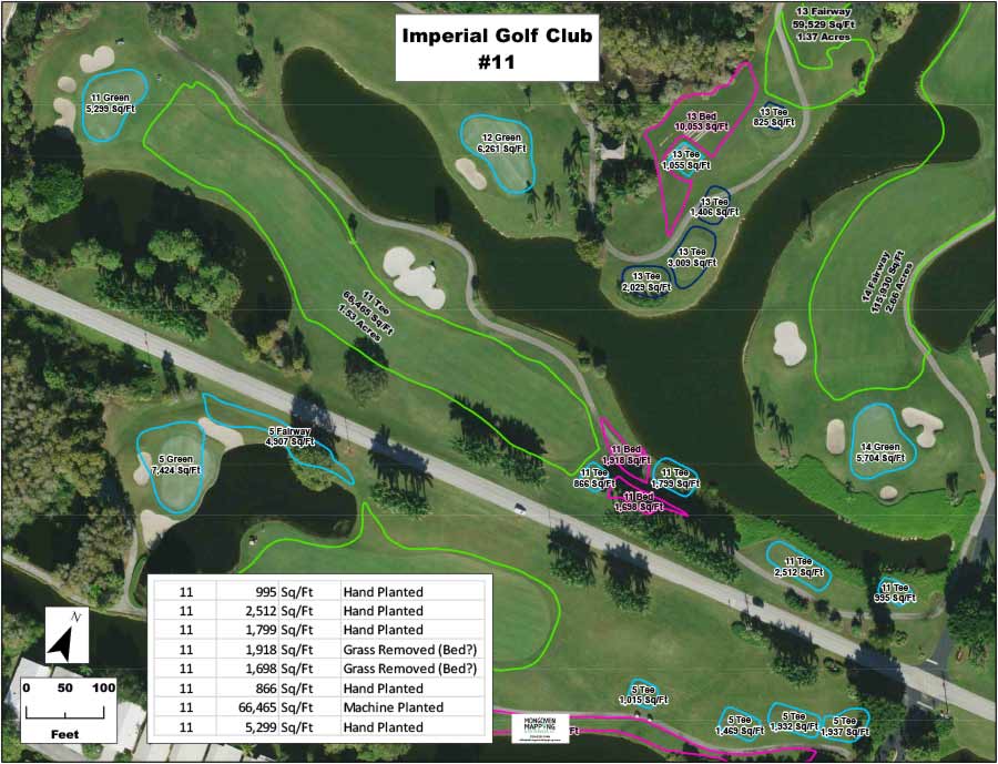
Construction related maps, documenting & providing data prior to construction as well as as-built maps which fulfill contract obligations and show community owners where utilities are after the construction is completed.
Irrigation/Utility As-Built Maps
We use a combination of location data collected in the field, cad plans and aerial images to provide outputs that meet the contractor’s obligations and are beneficial for the maintenance and operation of the irrigation systems going forward.
We Specialize In GOLF Courses & communities
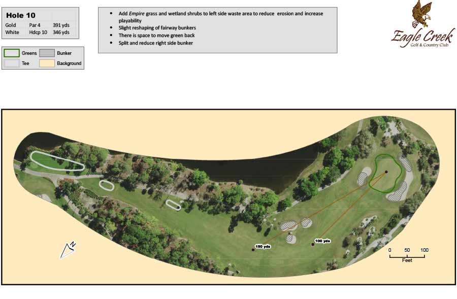
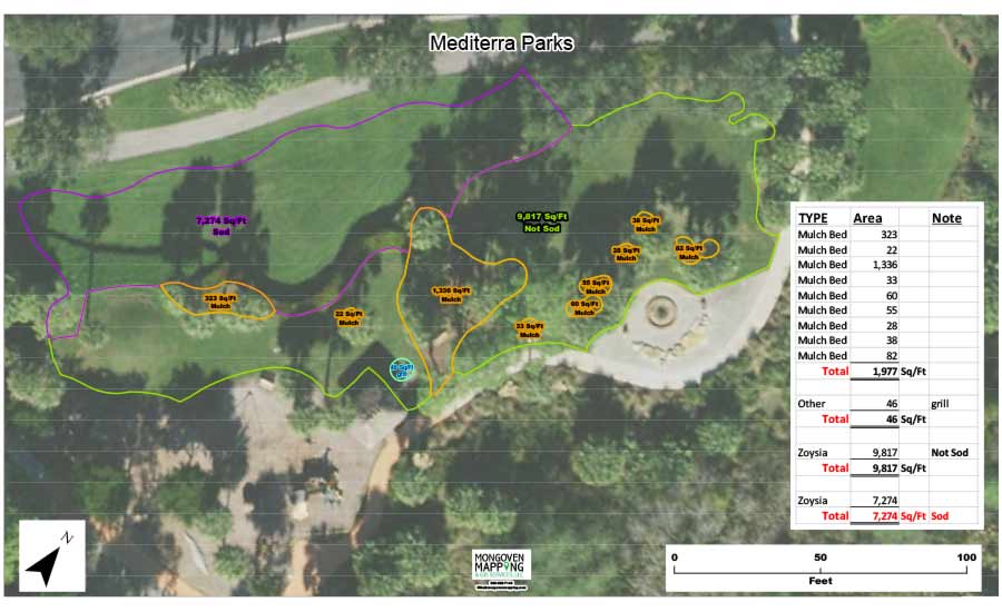
Golf Courses & Residential Community Mapping
Mapping of client selected features included but not limited to:
- Landscape Beds & Turf Areas
- Native Plant Beds
- Wildlife Habitat
- Golf Course Features & Trees
Values created by Mapping include:
- Budgets are objective rather than subjective.
- Communication, a thousand words.
- Planning for the present and future.
- Asset Protection – preventative maintenance rather than putting out fires.
- Training and Accountability
Output available in a variety of formats
CAD files, Electronic PDF files, Field Books, and Wall Maps